Tactile maps for visually challenged people

Data East with Siberian State University of Geosystems and Technologies started implementation of a complex Tactile maps project.
Data East with Siberian State University of Geosystems and Technologies started implementation of a complex Tactile maps project. Tactile maps (maps for blind and visually impaired people) play an essential role in education and social adaptation of visually challenged people. The main idea of the project is making our environment friendly for them. In the result, a series of specific materials for finding direction on the city streets and inside buildings and 3D maps and educational media will be created. This research project is developed with grant financing from Novosibirsk City Administration and is part of the ‘Accessible environment’ state program.
The tactile cartography rapidly develops along with development of science and technology, and various technical means and materials for printing three-dimensional graphic have appeared recently. The need for cartographic materials for visually impaired people is great, and so there is an urgent need for the approved methodic for creating tactile maps and 3D models, which could be used as a standard to provide educational institutions, municipalities, and other organizations working with visually challenged people with tactile cartographic materials.
Today, totally 218000 citizens of Russia have vision problems and all of them every day face multiple barriers in our unfriendly environment that is often poorly adapted for blind and visually impaired people. Despite of flourishing development of mobile sound assistance and navigation technologies, the problem of creation of tactile terrain maps, tactile route maps and layout maps of building interiors is still crucial. Modern additive technologies allow printing plastic tactile maps on 3D printers. As compared with 3D maps printed on microcapsule paper, plastic maps are much more durable and keep printed terrain relief as is for longer time.
Geoinformation systems provide powerful tools not only for visualization of geographic information, but also for its organization, analysis, and modeling of spatial processes. Digital representation of real world crucially differs from traditional paper mapping, as any map feature of any shape and literally of any scale can be displayed on the screen. This advantage makes GIS the ultimate tool for effective application of additive technologies in tactile maps development.
However, development of tactile maps requires a universal set of tactile symbols which can be sensed by most of the blind and visually impaired people. Until now, such universal tactile symbology has not yet been created. There are different standards applied in different countries, but they cannot be consistently used by all people around the world.
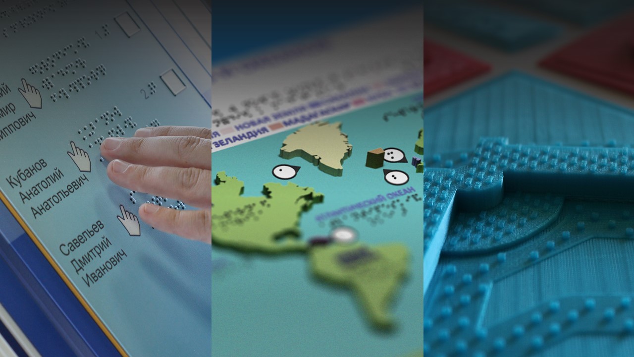
It is known that different user categories (children and adults) sense tactile symbols differently. In a perfect world every feature should have its tactile symbol, but visually impaired people just will not be able to remember such a huge number of symbols. That’s why it is required to find out what is the optimal number of tactile symbols and how they should be printed on map. For example, even a simple circle can be put on the map in two different ways: either as a convex solid object or as circle with convex border only. In the result of complex research made by Data East and Siberian State University of Geosystems and Technologies, the optimal technical characteristics of 3D printer were determined and the type of plastic material required for printing tactile 3D maps of proper sense perception was found. Based on the conducted experiments, the methodological recommendations for appearance of tactile map symbols and layout of tactile maps were presented. Besides, the research shown good sensible perception of Braille type printed on plastic 3D maps.
After the research the 3D map of Novosibirsk Park of Glory was developed, printed and tested. In the future, it is also planned to provide educational institutions with tactile cartographic materials.
Data East is now working on development of a software module provided to create tactile cartographic materials for visually impaired people. This work may take about two years, and in the result the module will be compatible with popular GIS platforms, including ArcGIS as the leading solution on modern GIS market.