The southeastern part of Kamchatka Peninsula
We have created one more interactive map for Kamchatka Peninsula enthusiasts. Our article is a next story about this amazing and distant place.
The southeastern part of Kamchatka Peninsula is the land of active volcanoes, picturesque bays and black sand beaches. This is an astonishing place on our planet! We have created another detailed interactive map of this area, added local wildlife attractions, provided them with descriptions and photos. It remains only to download this map from the map catalog in the mobile application CarryMap and hit the road.
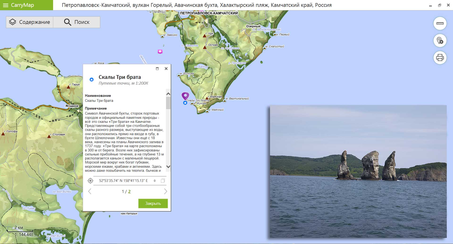
So, you have arrived to Petropavlovsk-Kamchatsky, be sure to go to a boat trip along the Avacha Bay. The bay is the main transport gateway of the Kamchatka Krai, and Petropavlovsk-Kamchatsky city is its main port, which serves fishing and cargo ships. The Avacha Bay never freezes, thus allowing not only to receive tourists, but also to operate the port all year round. At the entrance to the bay there is a set of three pillar-shaped rocks (kekurs) called Tri Brata (Three Brothers in Russian) protruding from the water. This picturesque stack is considered an official natural landmark and a kind of symbol of Avacha Bay and Petropavlovsk-Kamchatsky city. There is a legend, according to which three brave brothers tried to protect these lands from a tsunami wave coming from the ocean, but they angered the harsh god of the seas, who turned them into rocks for this audacity.
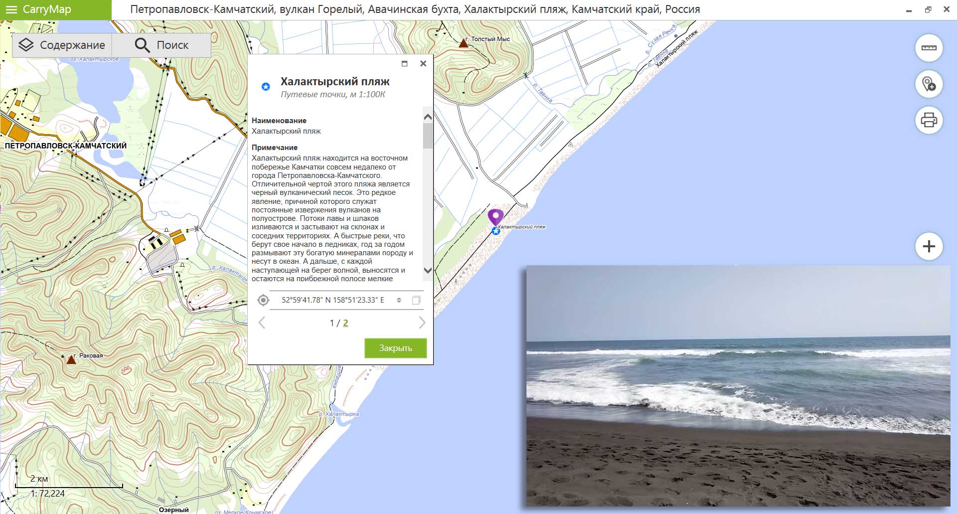
Near Petropavlovsk-Kamchatsky there is the Khalaktyrsky beach of black volcanic sand that stretches along the ocean for 50 km. Local active volcanoes erupt, lava pours out and solidifies on the slopes, fast rivers erode this mineral-rich rock year after year and carry it into the ocean. And then, with each wave coming ashore, small particles of volcanic origin are carried out and remain on the coastal strip. It is very cold to swim here even in summer, the water warms up to 15°C, but you can try surfing or just lie on the sand.
There are a lot of active volcanoes in the Kamchatka, for example Mutnovsky volcano, its activity is expressed by fumarolic activity. This is one of the largest geothermal deposits in the world. This volcano is one of the largest volcanos in the South Kamchatka and consists of the four craters formed by ancient explosions. Here you can feel yourself as if you are not on Earth, but on another planet.
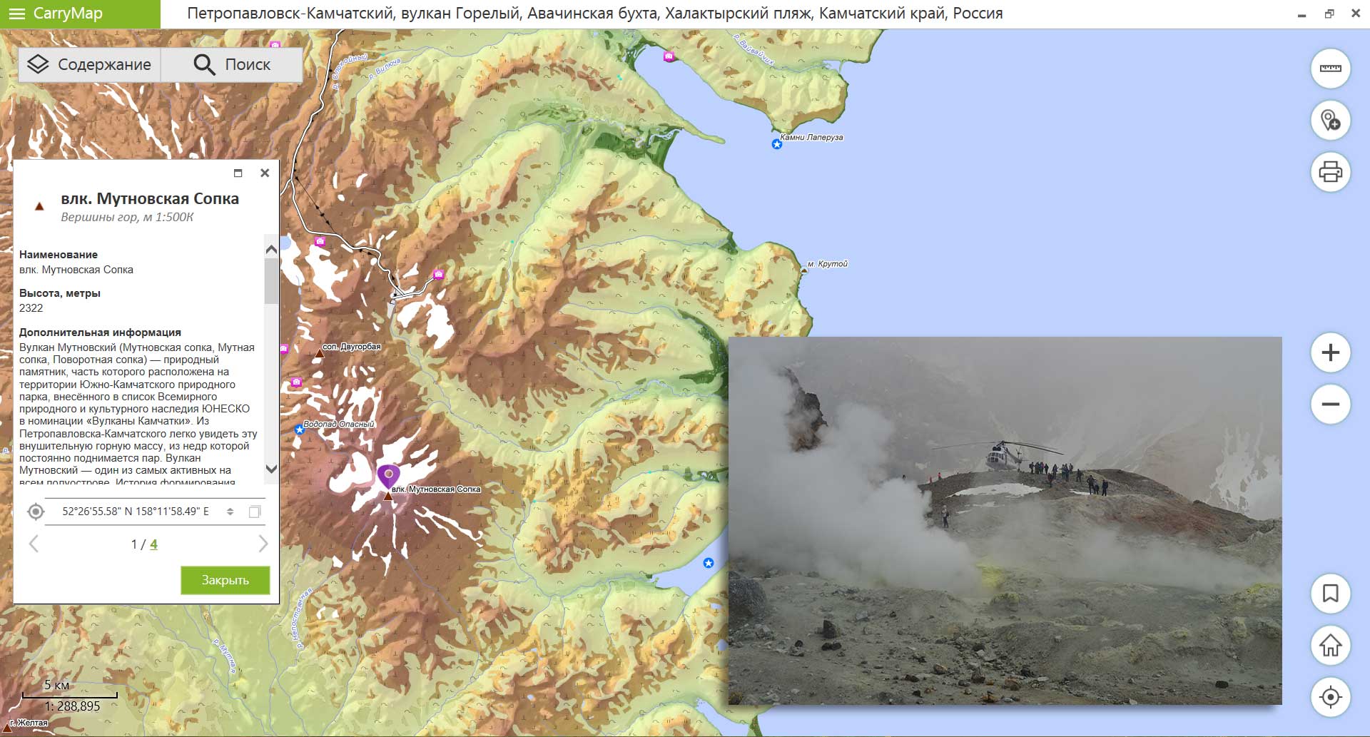
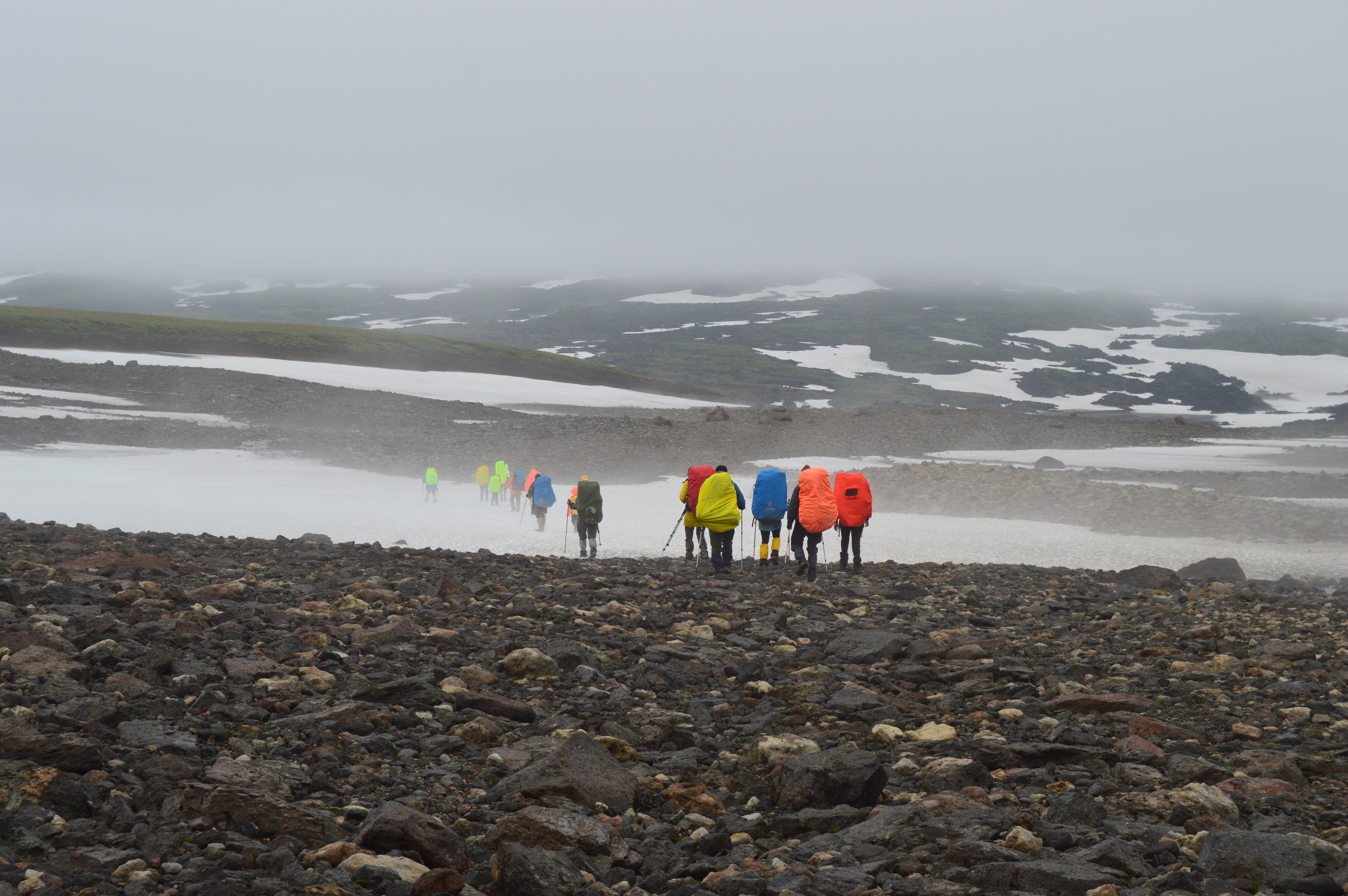
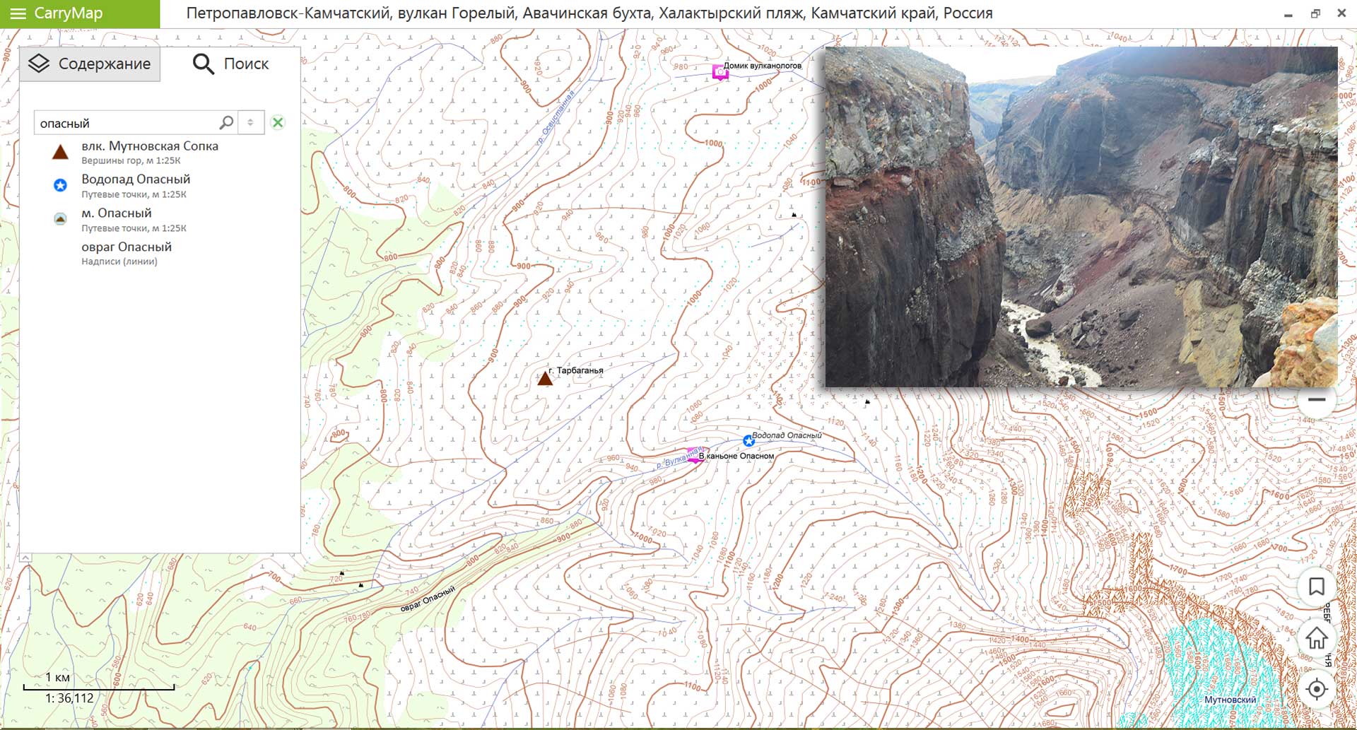
Volcano Mutnovsky is also divided by a gorge called Opasny (Dangerous in Russian) ravine. There are two ways to climb the volcano. The first path is longer, it starts at the Mutnovskaya geothermal station, but you can see Dachnye springs or a mini Valley of Geysers. The second path is shorter, but more difficult, as it passes along the bottom of a dried-up lake between the Gorely and Mutnovsky volcanoes, along the road there are sloping cliffs and glaciers.
Note that all options of the free mobile application CarryMap work without being connected to the Internet. Download mobile application on Android- and iOS-devices to travel using the map or Desktop application on Windows Desktop devices to plan travelling.
Download the map ‘Petropavlovsk-Kamchatsky, Gorely Volcano, Avacha bay, Khalaktyrsky beach, Kamchatka Krai, Russia’.