HERE Technologies and students use CarryMap for maps update

HERE Technologies has been actively cooperating with leading universities in Russia for more than 5 years implementing projects under the Young GIS specialists training program. In 2017, the Russian branch of HERE Technologies decided to use CarryMap as the main application for joint work with universities.
HERE Technologies has been actively cooperating with leading universities in Russia for more than 5 years implementing projects under the Young GIS specialists training program.
Within framework of such cooperation, HERE specialists, university principals, and students participate in joint projects and organize practical trainings. Being developed in 2013, today the GIS specialists training program has been implemented by nearly 30 universities in Russia and CIS countries - students are engaged in creation of geolocation framework in Map Creator web service, take part in field data collection and its further processing in the office, participate in trainings and mapatons dedicated to new products development and rapid mapping.

HERE Technologies is the world's leading geoinformation data platform. Core solution of HERE is a constantly evolving and updated map. The platform consolidates data from more than 80,000 sources, including global fleet of cartographic vehicles, GPS probe, vehicle sensors, and public data from local authorities. HERE Technologies provides developers with free access to the platform, based on which they can create and develop their own services and applications. The company supports projects related to improving road safety and development of smart cities.
One of the most interesting and important joint projects of HERE Technologies and universities was the “field” collection of cartographic data and its subsequent processing. It was a good opportunity for students to gain valuable skills for further professional development, including the ability to work in a team and rationally plan their tasks. It was also very useful for them to take an alternate look at the city and learn a lot of new things about it.
It is worth noting that prior to decide on the app for that project, HERE Technologies have been playing around with different data collection tools for a long time. The matter is that simple paper maps are often not convenient for use, because of too many attributes to be collected (addresses, points of interest, other objects), professional data collection equipment is very expensive, and besides this, a special approach for building seamless communication between universities was needed.
Mobile GIS has become increasingly popular and in-demand recently. The reason for this increasing popularity is a major distribution of smartphones and tablets, and a high degree of their adaptability for solving problems related to data collection. In 2017, the Russian branch of HERE Technologies decided to use CarryMap as the main application for joint work with universities.
CarryMap mobile application allows you to view electronic maps, created with CarryMap Builder extension on Android and iOS smartphones and tablets, as well as on Windows Desktop devices. Mobile maps can be created from any ArcMap document, preserving the original design and data structure, including legend, attributes, and attachments.
All functions of CarryMap application, including viewing maps, finding current GPS location, identifying, and searching for objects, are available even without internet access. The ability to add ArcGIS Online and OpenStreetMap online-basemaps allows to make mobile maps more informative and descriptive.
Why CarryMap has been chosen to solve the project tasks?
Today, we can no longer imagine life without smartphones and tablets. Moreover, mobile devices are simply irreplaceable for field data collection. Current market of mobile applications offers many options for solving a variety of tasks. CarryMap has been chosen due to several advantages that distinguish it from competitors.
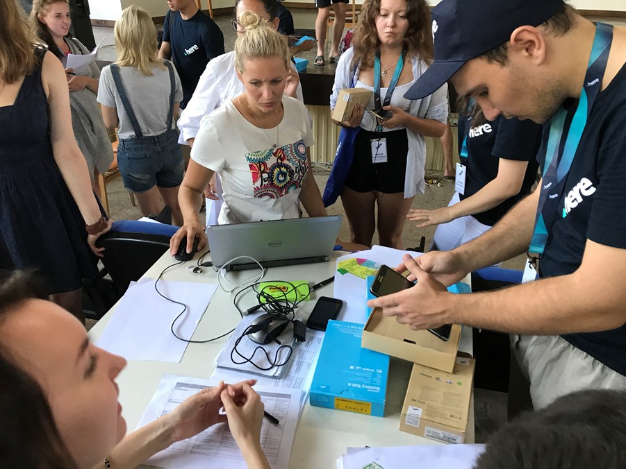
General briefing and delivery of equipment
One of such advantages is the possibility of full-functional work with mobile map even in offline mode, which is very important when out of internet coverage. So, no need to worry about internet availability while using CarryMap application as you can always find your bearings anywhere. The current location is determined via GPS/GLONASS navigation system of the mobile device.
CarryMap application uses standard GeoPackage format for data collection. The original structure of ArcGIS layers with all attributes is preserved while exporting collected data to this format, therefore exported layers can be used in CarryMap as templates for data collection. This opportunity makes it easier to collect data, because during the survey it is more convenient to fill out ready-made template, than to create a new structure on site. In addition, the standards applied at HERE Technologies were considered during creation of these templates, so the data collected by students were just what HERE wanted.
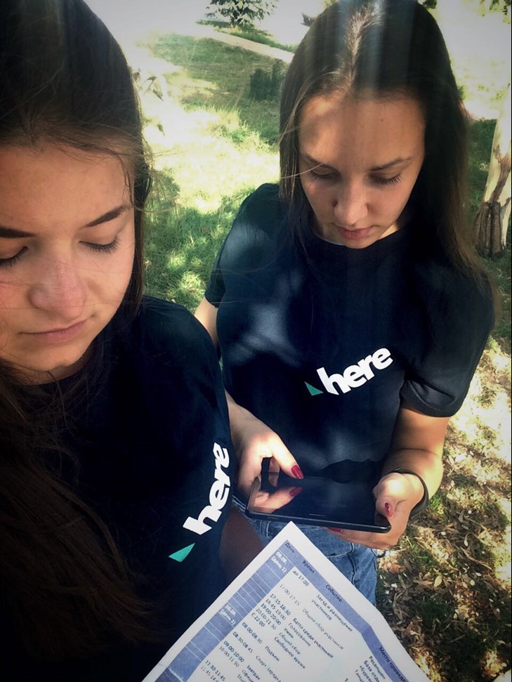
Field Data Collection
Many companies, including HERE Technologies, pay great attention to protecting their data from unauthorized access and distribution. CarryMap allows to solve this problem providing several options to protect mobile maps: set password, allow map to be opened on certain devices only, or specify certain amount of time, during which the mobile map will be available. As a result, each time the map is opened on mobile device, the user will be prompted for password or device ID, or the map's validity will be limited to specified dates.
Moreover, with CarryMap you can record GPS tracks along the way, update the attribute information of existing objects on the map (for example, add photo or video), create new objects as points, lines and polygons, search and identify objects, measure distances and areas.
Conclusion
CarryMap technology has been successfully utilized in #HERESochiCamp 2017 student camp project, held in Sochi in September 9-14, 2017. In the first fay day students were engaged in setting up equipment, preparing data for work, and conducted test data collection near Vishnevka village. The second day was entirely devoted to collection of field data on infrastructure facilities in Sochi. The simplicity of the application made it possible to perform all works on time and with acceptable data quality.
In this year CarryMap will be used in other projects of HERE Technologies. For example, in August 28 - September 3, the similar work will be done for #HERESochiCamp 2018 project to update data on points of interest and addresses in Sochi.
Photos in the material are provided by HERE Technologies.
Kirillov Sergey (Data East, LLC)
Rudoy Victor (HERE Technologies, LLC)