December 15, 2014
Reading time: 2 minute(s)
XTools Pro 11.1 with ArcMap 10.3 compatibility to be released in January 2015
Reading time: 2 minute(s)

Many of you were asking for that and we listened. New XTools Pro 11.1, aside from ArcMap 10.3 compatibility and other updates, will support rasters, group layers and multiple selected layers in Layer Properties Dockable Window.
Let's take a closer look at what’s on the way in 11.1
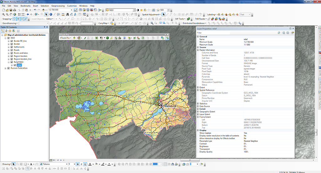
Raster properties
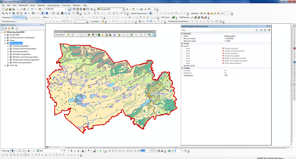
Group layers properties
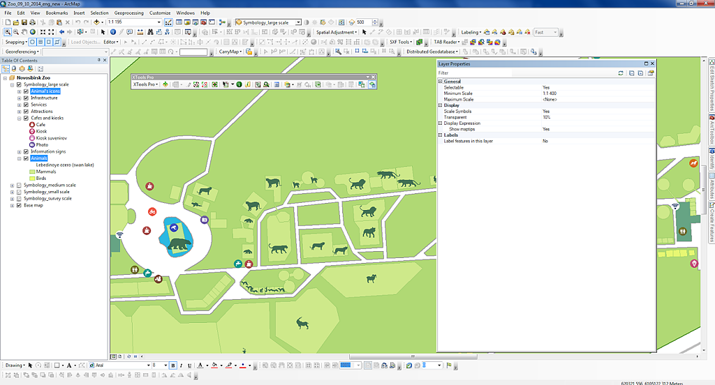
Multiple selected layers properties
Here is a list of all improvements we're about to release and tell you more about next month, in January 2015:
- ArcGIS 10.3 compatibility
- XTools Pro 11.1 can be installed and used with the new ArcGIS 10.3 - Layer Properties Dockable Window
- added support for rasters, group layers and multiple selected layers - Selection Manager
- a new option Select by symbology (available only with ArcGIS 10.x)
- multiple selections can now be selected - Extract Map
- added support for replicas for maps with SDE datasets - Identify Pro
- attribute field type and properties are now detected for edited attributes, wrong values not saved
- multiple features can now be identified with the Shift key
- now correctly shows selected/unselected features in the map
- identified features and attributes are not dropped in the Identify Pro results window after layers added/removed or turned on/off in the TOC window
- fixed resizing of the Identify Pro results window and status bar - Copy Layer Properties
- now supports layers with broken/missing data sources (all properties can be copied from such layers, but Labels, Symbology and Definition Query cannot be pasted to such layers) - Create Grid from Contours
- new triangulation algorithm used
- increased overall performance - Convert Grid to Contours
- fixed errors in processing Z factor and contour interval values - Open Attribute Table
- fixed errors with fonts
- minor bug fixes and stability improvements - Add XYZ Coordinates
- improved work with field names in the geoprocessing tool
- minor bug fixes - Change Datasources
- minor bug fixes and stability improvements - MXD Info
- fixed ArcGIS versions detected for map documents - Auto Save MXD
- activated auto saving is now correctly kept between ArcMap sessions in the Customize dialog - Convert Shapes to Centroids
- for weighted centroids calculated for groups of input features sum values now calculated instead of first values in the output - Other changes
- new 14-days trial period
- minor enhancements and bug fixes